Wednesday, April 4, 2012

Au Sable Point Beach -- Pictured Rocks National Lakeshore

Today I will post the rest of the pictures from my hike on Au Sable Point. I originally planned on walking down to the lighthouse, but once on the beach I decided to walk east to see how far back towards the log slide I could get. It has been a while since I walked this section of beach.

Although it was chilly, it was a beautiful day to be on the Lake Superior beach.


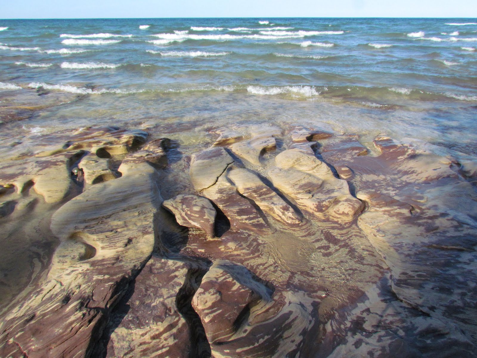
The patterns in the Jacobsville sandstone are amazing.


There are a lot of boulders on this stretch of beach. Over the millenniums the waves and ice of Lake Superior have pushed them across the shelves of sandstone.


Due to the low water levels, it is almost possible to walk the beach all the way to the base of the Log Slide.  There is one corner that requires you to walk out in the water, which I did not do.  This summer Ii am going to give it a try.


When I arrived to the corner, I turned back to continue west.  Then I spotted this huge six-foot in diameter boulder stuck in the side of the bluff left over from the post-glacial Lake Nipissing.  It is a glacial erratic dumped here over 10,000 years ago.  There were glacial scrapes on the boulder verifying that it was moved by the glacier.  I decided to use the boulder as a stepping "stone" to climb up the bluff. 

I knew that the trail was not that far inland, and at first I followed a little creek.


But then the vegetation became very thick.  It was quite a challenge to find my way through it.


Finally, I made my way back to the trail and headed back to my car.

Tuesday, April 3, 2012

Au Sable Trail

Yesterday the sun got me away from my computer. Although designing the online rockhounding adventures is tedious, I am enjoying it immensely. It is difficult for me to do anything else.

As I left my house, plans were to hike in the dunes, but I decided instead to investigate the trail that goes west from the Log Slide. I wanted to check the amount of water at the lower part of the trail given the lack of snow we had this winter. Every year I hike this trail in the spring and have always encountered massive wet areas on the trail due to the recently melted snow. I was curious if the same is true this year.
As I approached the log slide, there was this sign regarding the cell phone audio tour.


The number is 906-813-9010. This trial program only has five stops right now. You can call this number from anywhere to hear about the following stops:

Stop 1 -- Miners Castle
Stop 2 -- Au Sable Lighthouse
Stop 3 -- Munising Falls
Stop 4 -- Log Slide
Stop 5 -- Sable Falls

When you call the number, you press the stop number of choice. When the recording finishes, you can then select another stop number.

Then I headed west down the trail toward Au Sable Lighthouse.


When my kids were small, every time I took pictures of the Grand Sable Banks and Au Sable Lighthouse, they would say "Mom, you have taken those same pictures a million times."  Well here is a million and one.....

Notice the silt in the water that is still not settled after the northerly winds switched to come from the east.


I love walking in the woods during the spring.


The park is replacing the boards on the boardwalk.  This is a good year to accomplish this task because of the total lack of water.  There is almost no evidence of recent snow melt.


Here is a picture of an area that every other year I have seen pools of water.  There have even been some years that I was not able to get past this spot without walking in water.  As you can see, there is no water this year.


Around three quarters of the way to the lighthouse, there is a small footbridge.  From the bridge, you can climb down to the beach. This is one of my favorite spots, so I headed down to the beach.

Here is a photo I took of the top of a metamorphic gneiss boulder.  The boulder originated in the northwestern part of Ontario and was dumped in the Pictured Rocks National Lakeshore area by the glaciers.  Do you see the crawling lizard on top of the rock?


This section of beach provides a great view of the Grand Sable Banks.


The best part of this beach is that it is made up mostly of an outcropping of Jacobsville sandstone.
Jacobsville Sandstone is a red and tan sandstone found in the northern half of the Upper Peninsula,  portions of Ontario, and under much of Lake Superior. Desired for its durability and aesthetics, the sandstone was used as an architectural building stone, both locally and around the United States. The stone was extracted by thirty-two quarries throughout the Upper Peninsula approximately between 1870 and 1915.  In 1907, the Jacobsville Formation was given its current classification and the name Jacobsville, in honor of  Jacobesville, MI -- a town known for its production of the sandstone. There is disagreement regarding the age of the sandstone, though most agree that it was formed around a billion years ago.

The outcroppings of this sandstone in the U.P. is shown on the map below.


The stone is definitely photogenic, as you can see in the series of photos below.


Monday, April 2, 2012

Coaster Brook Trout

When I was at the Hurricane River the other day, they have an interpretive sign about coaster brook trout. There is something to be said about very large brook trout. They are the stuff of legends, and none has gained so fair a reputation over the decades as what is commonly referred to as the coaster brook trout.


Although a coaster is indeed a brook trout, complete with all the flashy markings and sweet-tasting flesh, these remarkable fish live most of their lives in the very competitive environment of Lake Superior.


The nickname, coaster, came about because these fish spawn, as brook trout do, in rivers and streams, but then they go out into the big lake, where they live most of their lives roaming along the coastline of Lake Superior, foraging, hopefully avoiding predators and growing large. In fact, coaster brook trout commonly grow to more than 26 inches. Brook trout that remain in the streams and rivers are significantly smaller.

The Michigan Department of Natural Resources for many years has been cooperating with numerous other agencies in the Lake Superior Basin to rehabilitate what has become a dwindling coaster brook trout population. Stocking and inventory programs have been the common thread with Michigan, Wisconsin, Minnesota and Ontario, but recently Michigan enacted further angling restrictions, especially in the area around Isle Royale National Park, where it is believed that remnants of unique strains of coaster brook trout still live.

The first map shows data about the coaster (red). The second map shows the current distribution of coasters (darker colors) compared to the historical range (lighter gray).


On Lake Superior, the minimum size limit for brook trout is 20 inches and the possession limit is one fish. Within four and one-half miles of Isle Royale National Park, catch-and-release fishing only is allowed and no fish can be kept.


Before European settlement, these beautiful fish were abundant in Lake Superior's tributaries and coastal regions. Their decline echoed that of the native grayling, and for the last century they have been locally extirpated or are extremely rare. Biologists think that extensive logging during the late 19th century destroyed a good deal of coaster brook trout stream reproduction habitat with the infiltration of sand and other sediments. Over-fishing and the invasion of the sea lamprey in the 1950s also are factors believed to have played a role in collapsing the Lake Superior coaster brook trout fishery.

Fisheries managers from around the basin established a working group in 1997 and have been closely coordinating everyone efforts ever since.   Raised from wild stock in government-operated hatcheries, some young trout are fixed with a passive integrated transponder tag, released when they reach four inches long and tracked to determine movement and mortality. The PIT tags have shown that coaster brook trout come and go from their home streams with frequency. The fish will move in and out of the home waters over the course of a few hours up to several days and more.

Here are photos from the interpretive sign at the Hurricane.


Sunday, April 1, 2012

Pictured Rocks National Lakeshore -- Hurricane River and More

Yesterday I finished my accounting and handed off the data to my tax preparer. Yea! That is always something to celebrate. So I decided to drive into the Pictured Rocks National Lakeshore and take a hike.

First I stopped at the Hurricane River.  The first thing I saw was a downed tree that seemed to have shattered in a storm.


There is a foot bridge for the North Country Hiking Trail.  From the middle of the bridge I pointed my camera north.  When it is cloudy, you certainly don't see the brilliant blue of Lake Superior.


I like using the sports setting on my camera to capture the dancing water.


Here is a shot looking up river.  Notice that the downed tree fell over the river.


Then I walked down to the beach to get a few shots. 


The beach in front of the Hurricane Campground is mostly sand.  It is a great place to hang out on a hot summer day.


I believe these are situated as seating to accommodate people listening to ranger presentations.


Next I headed over to Twelvemile Beach campground, which is located around three miles west of the Hurricane River.  When I was there last Monday, the entire surface was uniform in color due to the thin layer of a sandy film.  At that point the wind had been from the south for several days -- basically ever since the snow melted.  When the snow melted, it dumped the sandy film that the winds coming off Lake Superior had mixed in with the snow.  Here is the picture I took last Monday.


In the five days that elapsed since Monday, the winds turned to come from the north and blew most of the silt away.  There is still a lot of sand, but the ground was no longer a uniform color.


I walked up the nature trail from the campground.  In a future blog update I'll post the pictures from the hike.  Here are a few shots I took during the hike.


The picture below is wintergreen.  Wintergreen continues to photosynthesize throughout the winter.  Thus, it is an "evergreen."   Wintergreen berries, from Gaultheria procumbens, are used medicinally. Native Americans brewed a tea from the leaves to alleviate rheumatic symptoms, headache, fever, sore throat and various aches and pains. During the American Revolution, wintergreen leaves were used as a substitute for tea, which was scarce. Wintergreen is a common flavoring in American products ranging from chewing gum, mints and candies to smokeless tobacco It is also a common flavoring in mouthwash and toothpaste.  While hiking, I chewed on a couple of leaves.