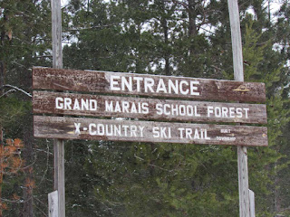
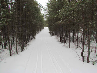
Today's blog update includes pictures taken during a cross country ski yesterday in Burt Township's School Forest. I parked at H58 and skied the road toward the bridge, went left and then right on Deer Lane. From that intersection I skied the road all the way to the Lake Superior shoreline. In total the ski is around seven miles.
During the summer you can actually drive this section -- with trees right next to your car on both sides.
In the woods the wind was not too bad. As I neared the bluff, it was big time intense. The chill factor was below zero. Notice the ice in the center of the picture. All of the warm temperatures lately has been causing these melts that later freeze.
This beach east of Grand Marais now has shore ice. The second row of ice (white streak) was around eight feet tall.
The waves were crashing into the wall of ice. Notice all the floating snowballs. After watching the shore ice build for the last 18 years since moving to Grand Marais full time, it seems that the ice building process involves:
- The surface water temperature just off shore must fall below 32 degrees.
- It must snow.
- Usually the snow is lake effect snow that happens when the wind picks up and blows over Lake Superior. At first the waves break pieces off the already existing shore ice.
- As the layer of floating ice balls expands, it actually cushions and protecst the outside wall of shore ice.
- The waves consolidate the floating ice against the shore ice wall.
- As the floating ice balls get pushed together, some of them accrete and mix with the new snow which helps to solidify the mix into larger floating ice balls.
- Waves both attach the ice balls to the row of shore ice and push them up onto the shore ice wall.
- If the wind dies down, the surface of the water next to the shore ice freezes. There can be large stretches of flat frozen ice that connects north of the last row of shore ice mounds.
- When the wind picks up again and if it snows (which often happens at the same time), the process of building a new row of shore ice mounds begins.
- Over the course of a normal winter (which this one is not), there can be rows of shore ice mounds connected by sections of flat ice going north off shore for great distances. Once since I lived full time in Grand Marais the ice formed all the way across Lake Superior.
- Throughout the winter and into the spring, the wind from an intense storm can break apart the rows of ice mounds. Some of the ice mounds turn into floating ice bergs. Sometimes a stiff south wind breaks off sections with multiple rows of shore ice. These large contiguous pieces float away from shore and can be seen as white ice floating across the lake towards Canada.
Usually ice forms up on shore first. The next row, which is shown in the photo below, is usually located just off shore. This year this shore ice building process is happening a month or two later than usual.
It is important to point out that this ice is not safe to walk on. Over the winter, this ice can form miles out from shore. Even the first row of ice mounds just off shore are not safe. There are holes in the ice that may be covered over with a thin layer of snow. Sometimes these holes go through the entire ice mound down to lake level. As this shore ice builds, it can be up to 40 feet thick. Most often the mounds are at least eight feet thick. If you slide down a chute into the water below the ice -- it is not likely that you will survive. Also, it seems that the ice is stable -- it is not. The ice can shift or break off right under your feet. Lastly, the ice is slippery. Many people get hurt because they fall on the ice.
After I took the shot below, I inched forward on my skies to the edge of the ice. The next thing I knew, the wind started blowing me across the ice. I was able to careful steer myself back off the ice and onto snow.
Then I skied back to the car, which I was very glad to see. Since I was skiing on the road, there were frozen snowmobile tracks under the two inches of new snow. The irregular surface underneath jerks you around. It is a constant test to your balance and definitely tiring. But it was worth it to be able to see the first row of shore ice forming out over the lake.
I have not posted pictures of my cats lately. Here are Lucky Jed and Ramsey.
Here are the references for yesterday's postings. As for the weather references, I don't remember exactly what the keywords were, but I searched Google for something like: "change in snow cover 2012 and 2011." In the process, I found this new source: http://www.climate4you.com/SnowCover.htm.
I really like the maps in the new source so I included them in today's update.
One of the other sources for yesterday's post was: http://snrclimatecorner.blogspot.com/2012/01/winter-2011-12-snow-cover.html
As for the earth tilt references, I Googled something like: "earthquake causes change in earth axis." I found several references including the two listed below. The estimate for change in earth tilt varied among all the articles.
http://content.usatoday.com/communities/sciencefair/post/2011/03/japan-earthquake-shifted-earth-axis-shorter-day-nasa/1
http://www.sott.net/articles/show/225741-Japan-s-quake-shifts-earth-s-axis-by-25-centimetres


No comments:
Post a Comment