Sunday, February 28, 2010

Evening in Grand Marais

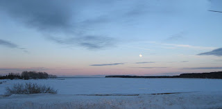
Last evening I was invited to dinner with a group of friends at a house east of town. It was a beautiful evening with a full moon. Here are a couple pictures of the moon.


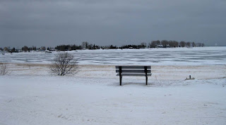
The view from my friend's house was impressive. As you can see, the bay is frozen, but not very thick. The first photo below was taken looking west toward town. When I arrived, my friends were just walking back from the frozen water's edge.


Since they told me not to bring any food, I figured I could at least bring a bin of agates and let people pick one out.

Thursday, February 25, 2010

Grand Marais Bay

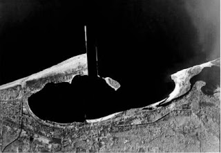
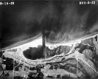
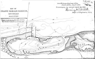
There is a public comment period until the end of the month regarding building a breakwater to protect the Grand Marais Bay. Although I am in favor of building a breakwater, I am concerned that the Army Corps of Engineers is recommending the cheap way out. They are suggesting that the angle of the breakwater be changed from the original that was built in the late 1800s, to a 55 degree angle slanted toward town. It is important for bays to have rivers that flow into them to "flush" them out. Originally, the Grand Marais Bay had several creeks that flowed into it. First Creek was diverted in the late 1800s. Once the original breakwater was built, the Sucker River was responsible for carrying out the majority of the flushing responsibility. The 55 degree angle breakwater would be built west of the Sucker River. As a result, the west Grand Marais bay could suffer the same consequence as the East Bay, which is now a land-locked marsh.

If they decide to "cheap it out" and there are unforeseen consequences, then it is not likely that the Army Corps of Engineers will fix the problem. That is exactly what happened with the pier that was re-built and extended in the 1960s. The Army Corps admitted that the re-design of the pier caused the erosion east of town. Many people lost property and homes, and the erosion "killed" East Bay. If they do build the new breakwater and their is unanticipated erosion, who knows what will happen.

I agree that we need a new breakwater. However, I think it is important that it be built at the same angle as the original. Granted, that the erosion requires over 7,000 feet of breakwater to obtain the same angle as the original breakwater that was only 5,000 feet long. But we know that the original angle WORKED FOR OVER 60 YEARS. We don't know what will happen if they change the angle.

The environmental assessments have been completed, and we have until February 28th to submit a final round of comments on this project to the U.S. Army Corps of Engineers. Please submit your letters of support!

The environmental assessment and a printable letter of support are online at:
www.saveyourharbor.com OR www.grandmaraismichigan.com

You can e-mail your comments to: gmbreakwallproject@gmail.com

You can mail your own letter to:
U.S. Army Engineer District, Detroit
ATTN: CELRE-PL-E (Les E. Weigum)
P.O. Box 1027
Detroit, MI 48231-1027

Please help us save our Grand Marais harbor but urge them to re-build the breakwater at the original angle.

Here are some photos of the history of the bay.

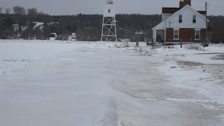
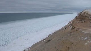
Recent photos of the harbor.


Harbor in 1964


Harbor in 1939


Harbor in 1903
Tuesday, February 23, 2010

Winter Scenes and Agate Photos

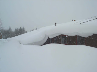
This posting includes a few miscellaneous winter photos. Last year I posted a picture of the deep snow on the south side of my house. Below is that shot, along with the same photo from this year. The difference illustrates the 75 inch deficit in our snow fall this winter.


For those of you who have followed the agatelady web page and blog, you know how much I like taking pictures of roadside Americana art. Here is a sculpture in a front yard in Curtis, MI.


To supplement my skiing time, I've kept a trail going behind my house. Every time I am out I knock down apples from the trees that for some strange reason never fell off the trees this past fall. I didn't see the deer myself, but friend Renee Beaver-Stocking saw an albino deer near the apple trees in the front of my house when she pulled up my driveway last night.


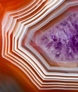
I have not included any agate photos on the blog as of late, so here are a couple of pictures from the new agate book. Both are photos found in Grand Marais by museum founder, Axel Niemi.


Monday, February 22, 2010

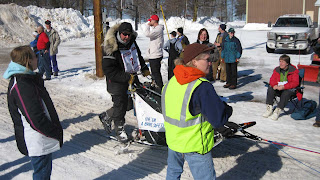
UP 200 Dog Sled Race

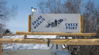
This past weekend was the UP 200 Dog Sled Race. It is a qualifying race for the Alaskan Iditarod race. Just over 30 teams entered and started in the Marquette area on Friday night. The teams started arriving in Grand Marais late Saturday morning. Grand Marais is the turn-around point. Each team is required to rest 16 hours, split between the three checkpoints.

This first picture was taken at what we locals call "four corners." It is located on H58 where the paved road turns west toward Sable Lake. This shot was taken from the intersection looking toward Sable Falls. You can see the snowmobilers that were stopped. The dog sled teams turn right and head across a field right in front of where the snowmobilers were stopped.


The arrival gate was located right in front of the museum. Unfortunately, I did not have the museum open. I spent the end of last week going over the first proof of the agate book and didn't have time to organize the museum's inventory. Everything is still in bins from my last art show in December. When the dog sled teams arrive, their official time is noted.


Then, volunteer handlers assist the team and lead the dogs to the area behind the recreation center. The dogs are fed and rested, as are the mushers.


The Grand Marais Women's club sold food, which is one of the club's fundraisers. There was also a silent auction and other items for sale to benefit the UP 200.


The last team left Grand Marais around 11:00 pm.

Sunday, February 21, 2010

Cross Country Photos

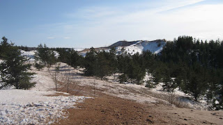
While skiing with friend, Dianna Bell, we left the normally groomed trail over by Sable Falls and skied on a snowshoe trail toward the sand dunes. When we got to the footbridge going over Sable Creek, we took our skies off and hiked into the dunes. It was such a glorious day -- second in a row with sunshine. That doesn't happen much in Grand Marais during the winter due to the lake effect clouds and snow. There was not much wind so the ice was floating off shore. You can see a couple of rows of icebergs hugging the shore, with the floating ice beyond that. Notice how there is more floating ice this day, compared to a week ago. If we get a strong wind from the north any time soon, it will continue to pile up the ice to form even bigger ice bergs.

Here are a few more photos from my ski trip the other day in the Seney Wildlife Refuge. The first photo shows the color contrast you can get in the woods during winter.


Throughout the Seney Refuge, there are creeks, rivers, and ponds that are managed to provide habitat for wildlife.


Along the ski trail we saw this tree that something had clawed the bark off. Some of the splinters were five inches long. We thought at first that a bear must have been looking for food, but then we realized that bears are supposed to be hibernating in the winter. We wondered whether it has been so mild that a bear woke up from hibernation a little early?


Along the edge of some of the fields the snow is starting to get a little sparse.


In the woods, though, there is still plenty of snow on the ski trails.

Thursday, February 18, 2010

Seney Refuge Ski Adventure

I had so much fun a couple of weeks ago skiing at the Seney National Wildlife Refuge, that I had to go back. Friend, Wendy, and I took off for a half-day adventure. It sure is nice to take a few days off after the long hours of working on the book.

The Seney Refuge has a series of dams and other gates that control the water levels of the ponds and wetlands. This photo was taken of the lichen growing on the concrete top of one of these gates.


Here is the gate and the open-water pond. There were animal tracks all over the place. The critters know where there is open water. I liked the patterns that developed on the ice that hung to the side bank of the pond.


This is the post-sunset shot I took from my driveway last night.

Wednesday, February 17, 2010

Winter Scenes around Grand Marais

Last Sunday I went snowshoeing with Friend, Renee Beaver-Stocking. We headed down the North Country Trail east of town. We talked with a family who has a cabin in the woods. I didn't get my camera out to get a great shot, but you can still see the "carriage" that the parents pulled by snowmobile to transport their kids and groceries. The second photo below is the Sucker River.


Our annual snowfall is down around 75 inches. For the first time this winter I saw ice in the channel out at Coast Guard Point.


This winter, the bay has frozen, broken up, and re-froze several times. Right now, it is frozen again -- but not solid.

Tuesday, February 16, 2010

More Winter Sand Dunes Photos

When we were up in the dunes the other day, I took quite a few pictures. Below are some more that were taken during the snowshoe. Notice how the shore photos this week look quite a bit different from those I shot a week or so ago. There was a lot more floating ice. The floating "pancakes" are shown in the third photo. We are getting stiff wind from the north today, so all that floating ice will pile up and make bigger icebergs. I'll get more shots in a few days and continue to do so to illustrate how dynamic the Lake Superior shoreline is during the winter.