Wednesday, June 23, 2010

Museum Gift Shop Photos

To continue the blog tour of the museum, I've included pictures of the gift shop below.


Monday, June 21, 2010

Museum Mineral Room Photos

Every year I try to refurbish or reorganize part of the museum. This year I completely redid the middle room that contains the mineral collection. I moved the chemistry cabinets to the middle of the room, relocated the display cabinets that were under the stairway out to the main room, and moved the black light fluorescent rock display under the stairway, which allows visitors to see the fluorescence much more dramatically. I also completely reorganized the rocks in the chemistry cabinets and added new interpretive information. To display some of the reprint photos from the new agate book that were kindly donated by Tom Shearer, I also removed Axel's driftwood collection and mounted the photos. The driftwood collection will be relocated to the theater corral, the building behind the museum. Here are some photos documenting the changes.


Sunday, June 20, 2010

Splash In Photos

The annual Splash In took place in Grand Marais yesterday. Unfortunately I was working the museum from 12-7, so I didn't get a chance to see the competitions in which the float planes participate. I did take a few photos of the planes lined up on the bay, as well as the planes flying overhead. I was told by others that 17 planes took part in the festivities.


Saturday, June 19, 2010

More Dunes Photos

Hiking in the dunes continues as Wendy and I had another long hike. The wild roses are in bloom everywhere in the dunes. Most of the rose bushes are only a foot or so tall. However, we came across this rose vine that had curled its way up an evergreen tree. It was around seven feet tall.


Throughout the dunes there are "ghost forests" where old tree stumps mark the battle fields between trees and shifting dunes. Here are a couple of the old trees.


Here are a few more dunes photos.


Thursday, June 17, 2010

Random Photos

When I take photos, I reduce the size and store them in a blog folder. Once I use the photos, they are transferred to a used blog folder. Here are a few shots I took the other night while hiking in the dunes with Wendy as well as a few left over from previous adventures. Wendy and I will be hiking the Grand Canyon with two of my other friends next January. I have hiked the canyon many times, but have never done it pain free. By starting to train early, I hope that it will be possible to hike and enjoy without sore muscles and joints. The sand dunes are the perfect place to train. Lately, we have been looking for and conquering the biggest dunes we can find.

Photos taken from the dunes and one of Sable River are below.


Wednesday, June 16, 2010

Geology of the middle section of the U.P. and more

First I have a few photos still to post from my Mackinac Island trip. The view from my friend Lee's house is spectacular. There are a few trees which make the view a little more mysterious. We enjoyed sitting on his porch and watching the boats travelling between St. Ignace and the island, as well as cars going over the Mackinac Bridge. Lee has the best view on the island of sunsets. Because of the angle of his property, he can see sunsets all year long.


When I drove over to St. Ignace I took M 28 to M123 and went through Trout Lake. I had noticed before when driving through the area that there are dune formations as well as dolomite and limestone formations. Both dolomite and limestone are sedimentary rock. Dolomite is the name of a sedimentary carbonate rock and a mineral, both composed of calcium magnesium carbonate. Dolomite rock (also dolostone) is composed predominantly of the mineral dolomite. Limestone that is partially replaced by dolomite is referred to as dolomitic limestone. Dolomite was first described in 1791 as the rock by the French naturalist and geologist, Déodat Gratet de Dolomieu (1750–1801) for exposures in the Dolomite Alps of northern Italy.

The mineral dolomite crystallizes in the trigonal-rhombohedral system. It forms white, gray to pink, commonly curved crystals, although it is usually massive. It has physical properties similar to those of the mineral calcite, but does not rapidly dissolve or effervesce (fizz) in dilute hydrochloric acid unless it is scratched or in powdered form. It is relatively soft with a Mohs hardness of 3.5 to 4.

Dolomite is a common sedimentary rock-forming mineral that can be found in massive beds several hundred feet thick. They are found all over the world and are quite common in sedimentary rock sequences. Disputes have arisen as to how these dolomite beds formed and the debate has been called the "Dolomite Problem". Dolomite at present time, does not form on the surface of the earth; yet massive layers of dolomite can be found in ancient rocks. That is quite a problem for sedimentologists who see sandstones, shales and limestones formed today almost before their eyes. Why no dolomite? Well there are no good simple answers, but it appears that dolomite rock is one of the few sedimentary rocks that undergoes a significant mineralogical change after it is deposited. They are originally deposited as calcite/aragonite rich limestones, but during a process call diagenesis the calcite and/or aragonite is altered to dolomite. The process is not metamorphism, but something just short of that. Magnesium rich ground waters that have a significant amount of salinity are probably crucial and warm, tropical near ocean environments are probably the best source of dolomite formation.

Both the dolomite and sand dunes in the middle section of the U.P. southeast of Newberry and northwest of St. Ignace are proof that ancient oceans at one time were in the area. Many of the dolomite outcroppings are near the Fred Dye Nature Sanctuary on M123.


Sunday, June 13, 2010

Golfing on Mackinac Island

Many golfers use "links" and "golf course" interchangeably. But "links" is actually a specific type of golf course. A traditional links course will have many - perhaps all - of the following features:

• The course is built along the seaside;
• The soil is sandy and drains easily;
• The course is laid out naturally, so that unusual bumps and slopes in the fairways and greens remain, rather than being smoothed over;
• The rough features natural seaside grasses;
• Bunkers are numerous, very small and very deep (to keep the seaside breezes from blowing the sand away)
• Fairways are rarely (if ever) watered and play firm and fast;
• Links courses usually have few if any trees;

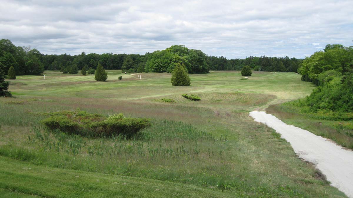
The Wawashkamo course is located in the center of the island. Part of the course is laid out on an old farm that also served as a battlefield. As the sign in the clubhouse explains, the course was named by a local Chippewa Native American meaning "walks a crooked path." This is the oldest links course in the country.


Here are photos of a couple of statues located next to the club house and the historical marker sign.


Thanks to friend, Lee Finkel, for the free golf advice as well as a day to remember.


Saturday, June 12, 2010

Mackinac Island Visit

I had an invitation to play golf on Mackinac Island this week. As hard as it is for me to close the museum for a day, I decided to do so. The other days this week I only had 3 or 4 people come into the museum, so I accepted the invitation. Since my friend's house and the golf course are both by the island's airport, I flew over rather than taking the ferry. Here are some photos to document the short flight.


When I coached volleyball and also chaperoned the teams during the time my kids were attending school in Grand Marais, I flew over to the island in the winter on several occasions. However, I have never flown over the Mackinaw Bridge when the straits are ice-free. The best view of the bridge is certainly from the air.


The short flight path took us over St. Ignace, above the bridge, past downtown, and around the west side of the island to the airport.


For those that do not know the story of Mackinaw Island, there are no cars allowed on the island other than emergency vehicles. Next to the airport local residents store their garden carts. When they fly to the mainland to go shopping, the carts are waiting for them to haul the items back to their houses. Bikes are the preferred source of transportation.