Saturday, January 7, 2012

Beach Hike and Breakwall Photos

Yesterday it did not feel like winter. Temperatures were in the 40s so some of the very little bit of snow we have melted. Before exercising, I decided to go out to the end of Coast Guard Point and see what the break wall and lighthouse look like. Amazing. Most years the channel leading into the harbor would be completely iced in. This year -- no ice at all. Normally there would also be large ice formations on the break wall. This year -- the break wall is coated with ice, but there are no accumulations.


Snowmobiles are few in numbers.  You can see it is difficult for them to find snow on which to ride.


No ice in the bay either.


Then I drove out to the School Forest and snowshoed the North Country Trail from the bridge to the shoreline.  Once I reached the shore, I decided to walk west with intentions of heading up the bluff at the next access point located around a half mile down shore.  It has been a few months since I have been to that access point so I didn't realize that the fall storms must have taken it out.  All of the bluffs were vertical and too high to climb, so I kept walking west.  First, here are a couple of pictures documenting what the beach looks like.  A shot looking west....


A shot looking east....


As I proceeded west, I was amazed at some of the ice formations on driftwood.


The top layer of the dune bluff is frozen, and is collapsing at the bottom.


More ice formations....


Then I reached a section with absolute devastation.  The power of Lake Superior is obvious.  All of the trees taken out by the fall storms were approximately 70 feet tall and more.  They were lined up on the bluff.


More ice...


There were also sections of the bluff that were absolutely vertical.  You can see where the top sections crumbled.  I knew that I had walked a lot farther west than I wanted.  Finally I saw a place that I could possibly diagonally walk up the frozen bluff.  At the top there was a ladder placed to allow you to get over the lip of the bluff.  Since this location was in the middle of the woods, I figured the home owner would not be there.  They were not.  At first I wasn't sure exactly where I was, but there were snowmobile tracks.  I followed the tracks back to the east and found the way back to my car.

Friday, January 6, 2012

Cross Country Ski and Sable Falls with Ice

Staff at the Pictured Rocks National Lakeshore groomed the cross country ski trails. However, the lack of snow resulted in twigs and grass showing through on some of the trail. With temperatures expected in the mid-30s today and next week, if we don't get more snow the trails will not be usable. But it was fun yesterday to be back on the groomed track! 


The parking lot for the ski trails are across the street from the Grand Sable Visitor Center.  Unfortunately, the center is not open in the winter.


When I skied past Sable Falls, I decided to take my skies off and carefully walk down the icy steps to see what the ice on Sable Falls looks like.  This first shot shows the section just above the main part of the falls.


Here is a shot of the main part of the falls.


The entire falls.....


A close up of some of the icicles....


The ice formations in the river are cool, too.


I love the contrast between the vegetation and the snow.


Thursday, January 5, 2012

Great Sable Dunes Snowshoe

Yesterday it wasn't as cold with temperatures in the 20s and some sun in between the lake effect clouds. I parked at Sable Lake and snowshoed across the dunes to Lake Superior. Then I circled back to the west before returning to Sable Lake.

First a picture of Sable Lake showing the solid ice cover.  As I left the parking lot and headed toward the dunes, I could see a very large animal about two miles down shore across the lake.  It was too big to be a deer, so I'm guessing it was a moose.  Unfortunately it was too far away and too quick for me to use the telephoto lens on my camera to get a better look or a photo.


As I was walking across the dunes, I spotted this flock of around 100 small birds feeding on seeds on the south side of a large dune.


This valley was very moon like.


I liked the contrast in color as well as the sharp ridges of this dune.

The clouds were quite dramatic as I approached the Lake Superior shoreline.


A shot looking east toward Grand Marais.


A close up of Coast Guard Point in Grand Marais.


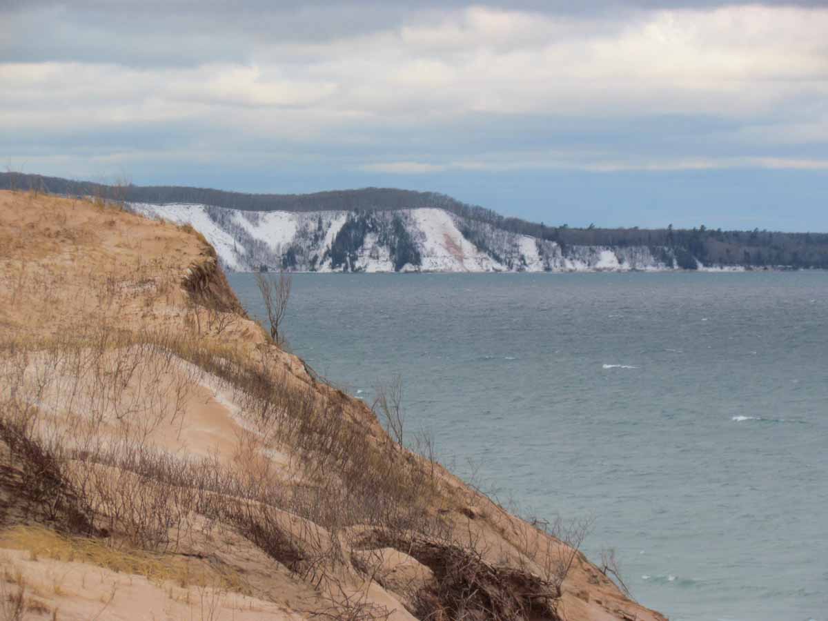
A shot looking west toward Au Sable Point.


I liked the colors with dune grass, sand, and snow.


A long distance shot of the breakwall and lighthouse.  Notice the waves splashing on the right side of the picture.


The sun was shining off the icy snow.


There were patches of sun throughout the area.


The banding pattern with layers of sand and snow looks like agate banding.


Wednesday, January 4, 2012

Logslide Trail and Dunes Snowshoe

Yesterday I decided to try to drive west of town down H58 to the Log Slide/Masse Homestead trail head.   Snowmobiles have packed down the snow so although it was a bit of a challenge, I was able to drive it without getting stuck. I walked down the trail around a half mile, headed up into the dunes, walked the ridges on the south side of the dunes, and back to the car. In the woods the snow is a bit deeper: around 8-12 inches deep depending on where you are. I was glad I had my snowshoes on.

First a picture looking southwest as I was snowshoeing down the trail.


More shots taken on the trail...


Now some dunes photos....


And a couple of Sable Lake that I took as I drove back.  Notice that the entire lake is now covered with ice.  Winter is definitely here.